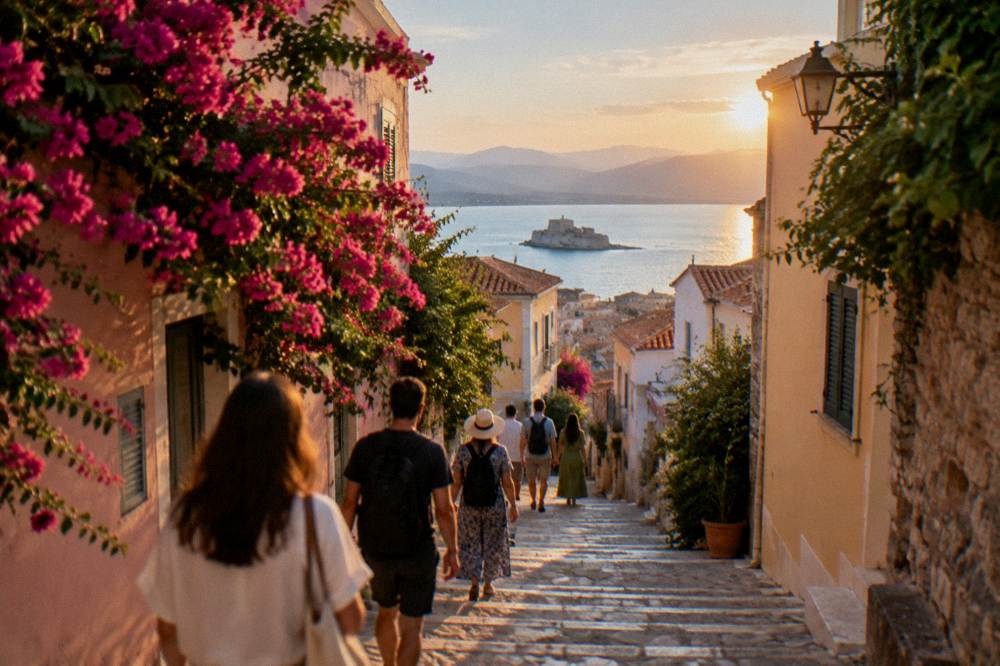
Arvanitia: The Rocky Cove Under The Walls
Arvanitia is the small rocky cove at the southern foot of Akronafplia, the old acropolis of Nafplio, a town of about 14,500 residents on the Argolic Gulf in the Argolid, in the north-east Peloponnese of mainland Greece.
Short answer
Arvanitia is a Blue Flag pebble and rock beach with a sandy seabed, at the end of a paved promenade of about 1 km that runs around the Akronafplia peninsula from the harbour side. It is organised in summer, with cafes, showers and sunbed rental reported by local guides, and it is reached on foot from the Old Town in minutes.
Arvanitia is the small rocky cove tucked under the southern walls of Akronafplia, the old acropolis that rises above the harbour of Nafplio, a coastal town of about 14,500 residents in the Argolid, on the Argolic Gulf in the north-east Peloponnese of mainland Greece. The name covers three things at once: the pebble beach itself, the square of cafes behind it in summer, and the paved seaside promenade of about 1 km that wraps around the Akronafplia peninsula from the harbour lighthouse to the cove. This page reports what the local guides, the weather record and the site's own data say about the cove, the walk and the swimming, and how Arvanitia fits into a stay that also takes in the Old Town and the harbour and waterfront.
What And Where Is Arvanitia In Nafplio?
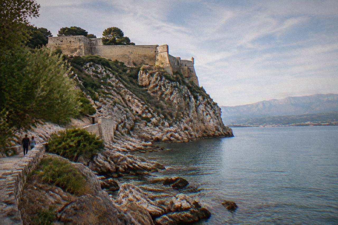
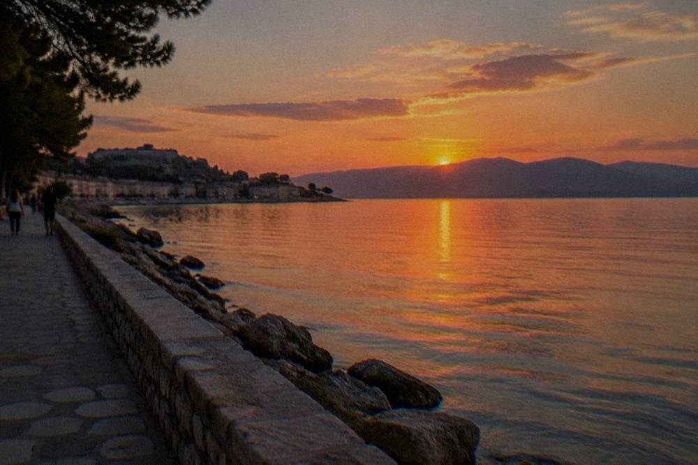
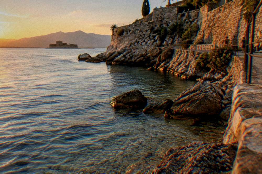
Arvanitia is a rocky cove on the southern side of the Akronafplia peninsula in Nafplio, immediately below the walls of the old acropolis and about a kilometre's paved walk from the harbour lighthouse on the west side. The beach is pebble and rock with a sandy seabed, and it holds a Blue Flag, according to the local guide site cityofnafplio.net. Above it stands Akronafplia, whose polygonal walls date from at least the end of the 4th century BC.
That combination is what makes the place unusual: a swimming spot sitting directly beneath fortification walls that span Mycenaean, Frankish, Venetian and Ottoman phases of the town's history. Akronafplia had a Frankish period from about 1210 to 1389, per the Argolis culture authority's monument page, before the first Venetian period began in 1389. The peninsula separates the main harbour and Old Town on the north side from the quieter cove on the south side, where the shore faces open water rather than the port.
Geographically, Arvanitia sits at the point where Nafplio's built-up edge meets the coast road that continues east toward Karathona and, further on, Tolo. The Pronoia district, home of the Lion of Bavaria carved from 1840 to 1841 by Christian Heinrich Siegel, lies just inland and uphill from the cove, so a visit combines naturally with the Pronia neighbourhood. Everything is compact: the whole strip from the Old Town through the promenade to the cove is walkable, and no vehicle is needed for the loop.
The cove also marks a boundary in the town's rhythm. North of the peninsula the waterfront faces the harbour, with Bourtzi offshore and the ferry-size ships of the cruise calendar anchoring beyond it; south of the peninsula the shore turns to rock, the road quietens, and the beaches take over. That single turn around the tip of Akronafplia is, in physical terms, the whole difference between the two sides of Nafplio a visitor encounters, and the promenade is the only car-free way to pass from one to the other.
How Long Is The Arvanitia Promenade And What Is The Walk Like?
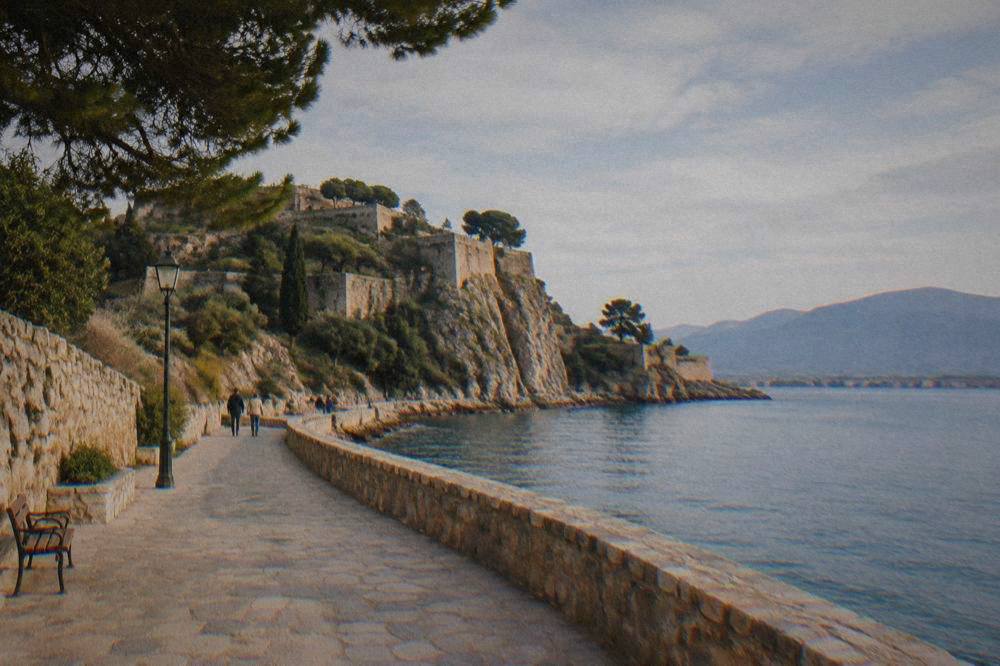
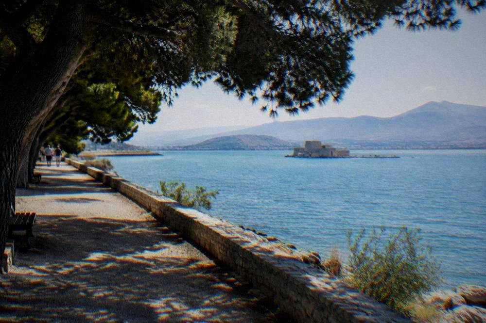
The Arvanitia promenade is a paved coastal path of about 1 km that runs from the harbour lighthouse around the foot of the Akronafplia peninsula to Arvanitia square and the beach, per cityofnafplio.net, which also describes it as the perimetrical walk around the acropolis. It is a sealed, walkable surface rather than a hiking trail, and it serves as the car-free link between the waterfront and the cove.
The walk is the reason the promenade shows up on so many Nafplio itineraries. On one side there is the rock face and the walls above, on the other the sea, and along the way there are views back toward Bourtzi, the small fortified islet in the harbour whose construction began in June 1471 to designs by Antonio Gambello. The path ends, or begins, at the cove, where the summer facilities sit. Because the surface is paved, the promenade suits ordinary shoes, and it carries walkers rather than demanding any real hike.
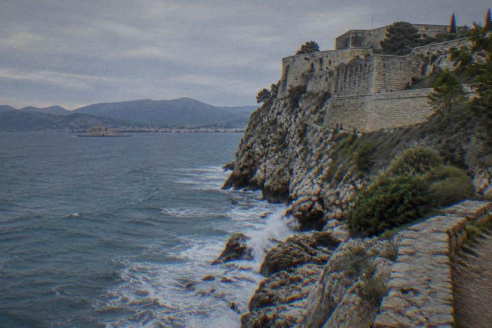
The rock itself rewards a closer look. The cliffs of the peninsula drop almost directly into the sea along the middle stretch of the path, and the walls above belong to successive builders: the polygonal masonry of the ancient acropolis, Frankish and Byzantine repairs, and the Venetian works of the periods from 1389 to 1540 and again from 1686 to 1715, after which the Ottomans held the town until the Greek capture of Palamidi in 1822. Reading the layers from below, on the walk out to the cove, is the quiet education the path offers at no cost at all.
One practical note the sources do support: rockfall and stabilisation works on the path were reported in 2025 and continuing into 2026, so check the current path status locally before setting out, as sections can be affected by works on any given day. The alternative access to the cove is by road from the Pronoia side, which avoids the path entirely.
A guided option covers this ground with commentary: the Nafplion City Walking Tour takes in the Old Town, the harbour and the walls above the cove, and Check availability on the operator's live listing for current departures. For planning a whole day around the walk, the two days in Nafplio itinerary places Arvanitia alongside Palamidi and the museums.
Can You Swim At Arvanitia And What Is The Beach Like?
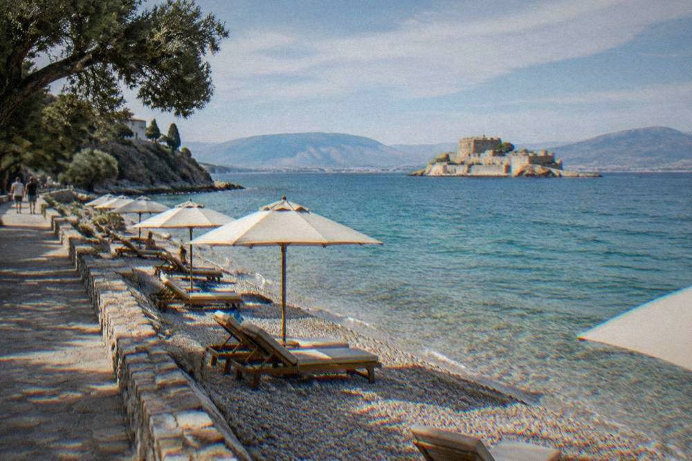
Arvanitia is a Blue Flag beach of pebble and rock with a sandy seabed, organised in summer with cafes, a bar and restaurant, changing rooms, showers, restrooms and sunbed and umbrella rental, plus an outdoor gym, per cityofnafplio.net. Entry to the water is over pebbles and rock, with ladders in places, so it is not a sandy walk-in swim.
The Blue Flag designation is the strongest water-quality signal available for the cove, though no monthly sea temperatures are published in the site's sources, so no water-temperature figure appears here. What the local guide describes is a rocky shore with a sandy bottom once you are in, which is the honest summary: comfortable in the water, less comfortable underfoot at the edge. Swim shoes are a reasonable response to pebble entry, and the ladders the same source mentions help at the rockier sections.
In summer the cove behaves like a small organised beach rather than a wild spot. The facilities listed above are seasonal, so outside the summer months the beach reverts to an unorganised pebble cove with the cafes behind it operating on their own schedules, which visitors should confirm locally. The cove faces south over open water, which shapes the day here: the morning sun arrives over the Akronafplia ridge, the afternoon belongs to the water, and the shade of the peninsula reaches the square behind the beach earlier than it reaches the sea itself. No sunbed or umbrella price is published in the sources, so check with the operator on the day.
For a sandy alternative, the sources point two ways: Karathona, reported at about 3 to 5 km from the Old Town and around 30 to 45 minutes on foot via the Arvanitia path, is a long sandy beach, and Tolo, about 11 km and 17 minutes by road from Syntagma Square, is the nearest sandy beach resort. The wider beach picture is covered in the Nafplio beaches guide.
What Is The Weather Like At Arvanitia Through The Year?
The climate record for the area comes from the HNMS Argos station, 1980 to 2010, an inland station about 10 km north-west of town: mean daily highs run from 14.6 C in January to 34.0 C in July, and rainfall runs from 8.9 mm in June to 82.5 mm in November, with 471 mm across the year. The waterfront can differ slightly from this inland record.
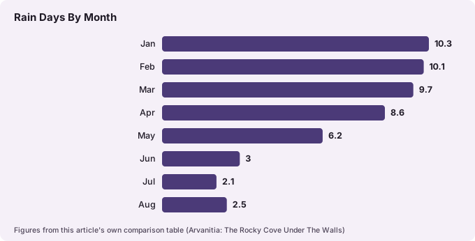
Those two months, June and November, frame the swimming question better than any general claim about "the season". June has a mean high of 31.4 C with a mean low of 14.0 C and only 3.0 rain days on average, while September cools to a 29.7 C mean high with 5.0 rain days. July and August sit at 34.0 and 33.7 C mean highs, with 2.1 and 2.5 rain days respectively, which is the weather window the summer beach facilities are built around.
| Month | Mean daily high C | Mean daily low C | Rain mm | Rain days |
|---|---|---|---|---|
| Jan | 14.6 | 3.0 | 66.5 | 10.3 |
| Feb | 14.7 | 2.9 | 52.5 | 10.1 |
| Mar | 17.4 | 4.3 | 52.2 | 9.7 |
| Apr | 21.3 | 6.7 | 33.7 | 8.6 |
| May | 26.5 | 10.5 | 18.7 | 6.2 |
| Jun | 31.4 | 14.0 | 8.9 | 3.0 |
| Jul | 34.0 | 16.7 | 9.1 | 2.1 |
| Aug | 33.7 | 16.8 | 13.0 | 2.5 |
| Sep | 29.7 | 14.2 | 20.3 | 5.0 |
| Oct | 24.7 | 11.5 | 44.3 | 6.9 |
| Nov | 19.2 | 7.7 | 82.5 | 9.4 |
| Dec | 15.5 | 4.8 | 69.7 | 12.2 |
All figures are HNMS Argos station, 1980 to 2010. November carries the highest monthly rain total in the record at 82.5 mm, and February the lowest mean daily low at 2.9 C, so an off-season walk on the promenade is a matter of choosing the dry window rather than avoiding cold alone. Even in January the mean high sits at 14.6 C, which keeps the coastal walk plausible in a jacket.
The shoulder months deserve a second look from the table. May combines a 26.5 C mean high with only 6.2 rain days, and October still offers a 24.7 C mean high against 6.9 rain days, which supports the pattern of walking the promenade and dipping in and out of the cafes outside the peak. Rain in this record is concentrated in the November-to-February stretch, where four consecutive months each carry more than 52 mm, so the cove's quieter season and the record's wetter season overlap almost exactly.
How Do You Get To Arvanitia And What Is Nearby?
Arvanitia is reached on foot from the Old Town via the paved promenade of about 1 km from the harbour lighthouse, or by road from the Pronoia side; no bus or ferry is involved, and the whole circuit of Old Town, promenade and cove is a walking outing. Karathona lies about 3 to 5 km further along the coast on foot, per secondary sources, and Tolo is 11 km and about 17 minutes by road from Syntagma Square.
For anyone staying in the Old Town the question answers itself: walk down to the waterfront, pick up the promenade at the lighthouse end, and the cove arrives at the end of the paved stretch. Arriving by car, the Old Town is largely closed to visitor parking, with free public lots reported on the Akti Miaouli waterfront, so the practical pattern is parking at the waterfront and continuing on foot. From the cruise tender point the cove is likewise a walk rather than a transfer, and there is no train to Nafplio in 2026 and no scheduled ferry from the port to anywhere, so wheels end at the edge of the Old Town either way.
The near neighbors fall into a tidy distance ladder from Syntagma Square, all computed over free-flow routing:
| Place | Distance from Syntagma Square | Drive time (about) |
|---|---|---|
| Akronafplia (above the cove) | within walking distance | not applicable |
| Karathona | about 3 to 5 km on foot via the path | 17 min by road to the beach area |
| Tolo | 11.4 km | 17 min |
| Tiryns | 8.3 km | 12 min |
| Argos | 14.5 km | 18 min |
| Mycenae | 25.4 km | 32 min |
| Epidaurus theatre | 27.7 km | 41 min |
That ladder is why Arvanitia works as both a morning swim and the tail end of a sightseeing day. Palamidi Fortress, 216 m above the Old Town with about 850 steps on its stairway (not the legendary 999), sits at the eastern end of the same peninsula ridge, and the Palamidi Fortress and Akronafplia pages cover both fortresses in detail. A common loop described across the site's itineraries is Palamidi first, down into the Old Town, then the promenade around to Arvanitia for a swim, a pattern the one day in Nafplio plan spells out hour by hour.
What Are The Opening Hours And Tickets For The Sights Around Arvanitia?
The sight closest above Arvanitia, Akronafplia, has no published admission or hours, but the paid sights of the standard loop are Palamidi at 20 euro full and 10 euro reduced in 2026, Bourtzi at 7 and 5, and the Archaeological Museum of Nafplio at 10 and 5, all per the Ministry of Culture's pages. Palamidi runs 08:30 to 15:30 in winter and from 08:00 to 20:00 from 2 May 2026.
Those hours matter for the cove because the natural day runs fortress first, swim second: Palamidi's summer closing at 20:00 leaves the late afternoon free for the promenade and the water, while the winter schedule of 08:30 to 15:30 pushes the fortress into the morning and leaves the walk to Arvanitia as the daylight tail of the day. The Archaeological Museum of Nafplio keeps 08:30 to 15:30 all year and closes every Tuesday, so a Tuesday arrival reshuffles the museum out of the loop. The reduced tickets are sold only from 1 October to 31 May.
| Sight | Full ticket | Reduced ticket | Hours (2026) |
|---|---|---|---|
| Palamidi Fortress | 20 EUR | 10 EUR (1 Oct to 31 May only) | winter 08:30 to 15:30; April 08:00 to 19:00; from 2 May 08:00 to 20:00 |
| Bourtzi | 7 EUR | 5 EUR | Nov to Dec 09:00 to 17:00; Jul to Aug 09:00 to 21:00; access by boat for a fee |
| Archaeological Museum of Nafplio | 10 EUR | 5 EUR | 08:30 to 15:30 all year, closed Tuesday |
| Akronafplia | no published admission | no published admission | open ground; check locally for path status |
The state free-admission days apply across the paid sites above: 6 March, 18 April, 18 May, the last weekend of September, every first and third Sunday from 1 November to 31 March, and 28 October. A free-day visit to Palamidi before the walk down to the cove is the closest thing Nafplio has to a zero-cost sightseeing day, and the views from the fortress over the Arvanitia shore put the whole geography of this page in a single glance.
What Is There To Do Around Arvanitia Beyond Swimming?
Around Arvanitia the reported activities are the promenade walk itself, the summer beach facilities including an outdoor gym, the cafes and restaurant at the cove, and the climb to Palamidi Fortress or up through Akronafplia, plus the short walk into Pronoia to see the Lion of Bavaria, carved from 1840 to 1841. Everything sits within walking distance of the cove.
The walk-and-swim pattern is the core, but the surroundings add history and food. Akronafplia's walls above the cove are the ancient layer of the town's defences visible from the path, with polygonal masonry from at least the end of the 4th century BC, per the Argolis culture authority. The Lion of Bavaria in Pronoia, a copy of Thorvaldsen's Lion of Lucerne carved by Christian Heinrich Siegel for the Bavarian soldiers who died in Nafplio, is a solemn, quietly famous monument a short walk uphill, and it pairs naturally with a circuit of the cove.
The cooking classes run in the town a short walk from the cove, and the Epidaurus entry product covers the theatre and sanctuary down the road for a half-day extension.
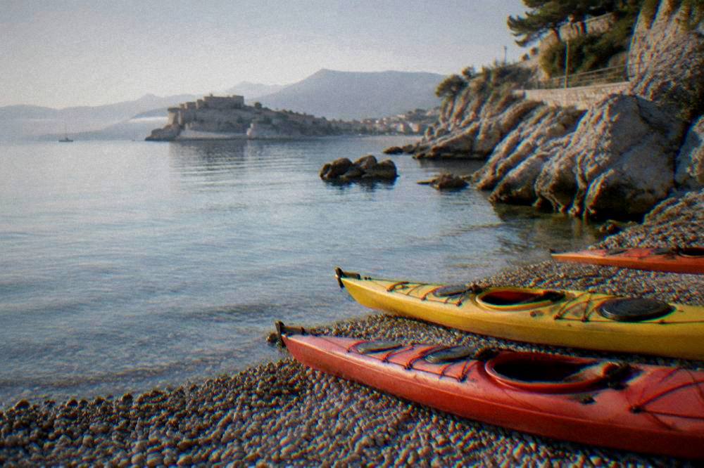
The sea itself is a second activity layer. Kayak trips paddle below the medieval castles along this exact stretch of coast, and sailing and catamaran cruises depart from the harbour on the other side of the peninsula, covered in the site's cruise pages. None of these figures are typed here: prices, ratings and durations render on the operator listings themselves.
Where Does Arvanitia Fit In A Nafplio Itinerary?
Arvanitia fits a Nafplio itinerary as the half-day or evening walking and swimming segment: the promenade loop plus a swim takes an hour or two, it sits within walking distance of the Old Town and Palamidi, and it pairs naturally with Pronoia and the Lion of Bavaria on the same loop. First-time visitors usually slot it after the fortress and before dinner.
The reason is geography. The town's main sights form a compact cluster: Syntagma Square at the centre, the Archaeological Museum on it, the harbour and Bourtzi to the south-west, Palamidi above to the east, and Arvanitia behind the peninsula to the south. A day can run square, museum, fortress, promenade, cove without ever needing a car, and the evening light on the water from the path is one of the town's standard photography moments, covered in the site's photography guide.
Longer stays stretch the same cluster outward. The three days in Nafplio plan adds Mycenae and Epidaurus, both 20 euro full and 10 euro reduced in 2026 per the Ministry of Culture's pages, with Mycenae about 32 minutes and the Epidaurus theatre about 41 minutes by road. The Mycenae day trip page handles that extension in detail.
For visitors arriving from the capital, the town also works as a base, and the question of how many days to spend and how to split them between town, fortress and cove on one side and the archaeological sites on the other is handled in the Nafplio day trip from Athens pages. What Arvanitia contributes to that calculation is simple: it is the part of Nafplio that needs no ticket, no car and no timetable, just the paved kilometre between the harbour and the cove.
Common Questions About Arvanitia In Nafplio
Is Arvanitia beach sandy?
No. Arvanitia is a pebble and rock beach with a sandy seabed, per cityofnafplio.net, with ladders at the rockier sections. For sand, Karathona and Tolo are the sandy alternatives the sources point to.
How long is the walk to Arvanitia from Nafplio Old Town?
The paved promenade around Akronafplia from the harbour lighthouse to Arvanitia is about 1 km, per cityofnafplio.net. The walk from the centre of the Old Town to the cove is a short outing on a sealed path.
Is the Arvanitia promenade open?
Stabilisation works after rockfall were reported on the path in 2025 and continuing into 2026, so check the current path status locally before walking. The cove can also be reached by road from the Pronoia side.
Does Arvanitia have facilities?
Yes, in summer: cafes, a bar and restaurant, changing rooms, showers, restrooms, sunbed and umbrella rental and an outdoor gym are reported by cityofnafplio.net. Outside summer the beach is unorganised, and facilities should be confirmed locally.
Can you walk from Arvanitia to Karathona?
Secondary sources report Karathona at about 3 to 5 km from the Old Town, around 30 to 45 minutes on foot via the Arvanitia path. Check the current path status locally, given the reported works.
Is Arvanitia good for swimming with children?
The beach is Blue Flag with a sandy seabed, but entry is over pebble and rock with ladders, not sand. No safety or access verdict is stated here; families should assess the entry conditions on the day.
Arvanitia remains what the sources describe and what the town's geography guarantees: a Blue Flag rocky cove at the end of a paved kilometre under walls that predate every empire that held the town, five minutes from the centre of Nafplio and open to anyone who walks. This page sits alongside the wider coverage on Nafplio Travel Guide, where the promenade, the cove and the fortress above them are placed in the full context of a town that was the capital of Greece from 1827 to 1834 and still keeps its walls, its harbour and its swimming spot within one short loop.