Leonidio And Kosmas: The Red Cliffs Of Tsakonia
This page lays out what the trip involves and how it compares with the other long day trips out of Nafplio.
Short answer
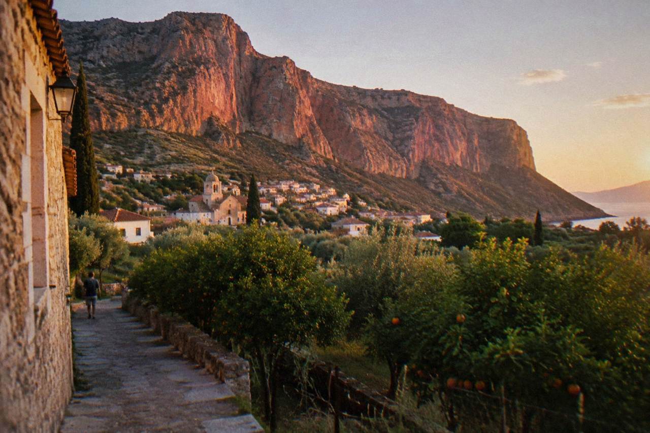
Leonidio and Kosmas sit in Tsakonia, the south-eastern corner of the Argolid behind the Parnon range, reached from Nafplio by road. The card gives no drive time for either place, so plan the route on a mapping service before setting out, and treat the pair as a full day out of Nafplio rather than a half one.
The Argolid does not stop at Epidaurus and Tolo. South and east of Nafplio, past the lemon groves of the coastal plain, the Parnon range folds the south-eastern corner of the region into a landscape of deep valleys, terraced slopes and a coast that faces the Myrtoan Sea rather than the Argolic Gulf. This is Tsakonia, and its two anchor points are Leonidio, a town built along a river valley beneath walls of red rock, and Kosmas, a mountain village on the heights above. Neither appears on the standard first-time Nafplio itinerary, which is exactly why they suit a second visit or a long stay, and this page from the Nafplio Travel Guide sets out what the trip involves and what can be stated with confidence.
Where Are Leonidio And Kosmas In Relation To Nafplio?
Leonidio is a town in Tsakonia, the south-eastern part of the Argolid, built on the Dafnon valley floor under tall red cliffs, and Kosmas is a mountain village on the Parnon slopes above it. Both are reached from Nafplio by road heading south-east through the Argolid, on a route that leaves the Mycenae-Epidaurus corridor behind.
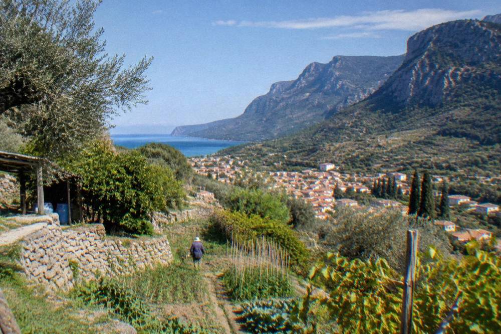
Tsakonia is the name for the traditional area around Leonidio and the Parnon villages, and the name carries a linguistic weight the map does not show: the area is associated with the Tsakonian language, a descendant of ancient Greek Doric rather than of the koine that became modern Greek. That heritage is the reason the region keeps its own identity, its own building traditions and its own agricultural calendar, distinct from the plains around Argos and Nafplio. The landscape makes the point physically. Where the north of the Argolid opens into olive and citrus flats, Tsakonia climbs, and Leonidio sits in the transition, a working town with terraced hillsides above it.
The practical consequence for a Nafplio-based traveller is simple: this is a full-day loop, not a quick hop. The route out of Nafplio runs through the southern Argolid, and once past the last of the plains the road becomes mountain driving, with bends, shade and short tunnels of plane trees between villages. Anyone comfortable with the drive to Monemvasia, about 219 minutes and 208 km by road from Syntagma Square per this site's computed figures, will find the Tsakonian roads shorter but similar in character.
Why Do The Red Cliffs Of Leonidio Draw Photographers?
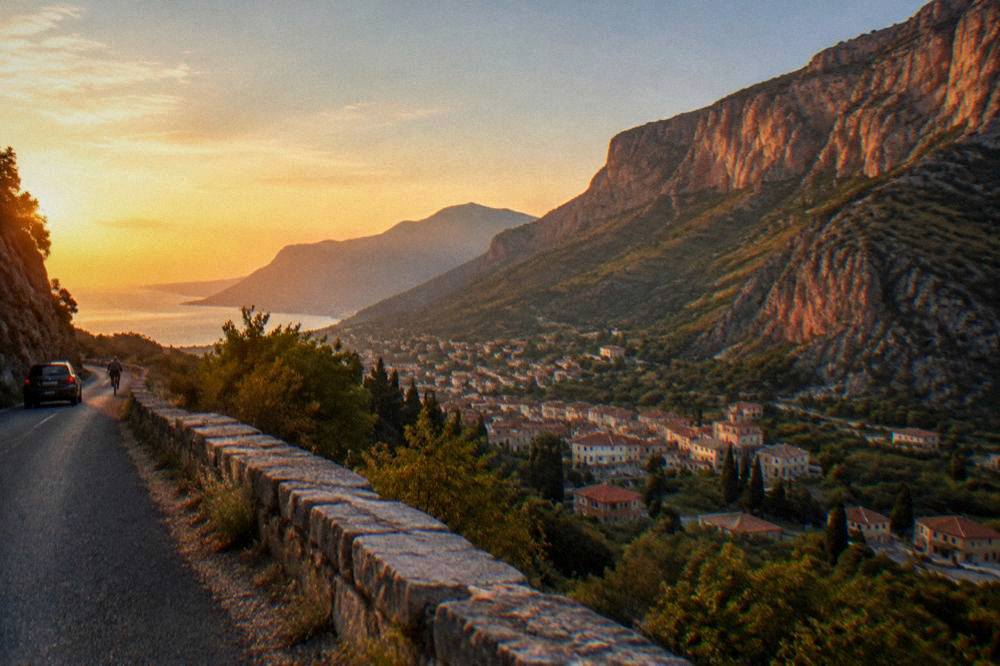
Leonidio's cliffs are the town's defining feature: tall, vertically fractured walls of red and orange rock that rise directly behind the rooftops, unusual enough that they anchor the town's whole visual identity. The rock face catches low sun in a way the plain towns never do, which is why the morning and late-afternoon hours are the ones photographers plan around.
The cliffs are made of conglomerate and softer sediments, and their colour changes with the light, pale pink at midday and deep rust toward evening. The town sits on the valley floor beside the Dafnon, a seasonal river, and the streets run with the grain of the valley rather than in a grid, so the rock face appears and disappears between buildings as you move. The practical advice is to walk rather than drive once in town: the cliffs reveal themselves street by street, and the scale only registers on foot.
Two further notes matter for planning. First, the valley around Leonidio is agricultural, known in Greece for its early spring produce and its terrace farming, and the orchard rows on the slopes make a quieter photographic subject than the cliffs themselves.
What Is Kosmas And Why Do People Drive Up From Nafplio?
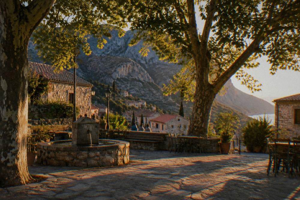
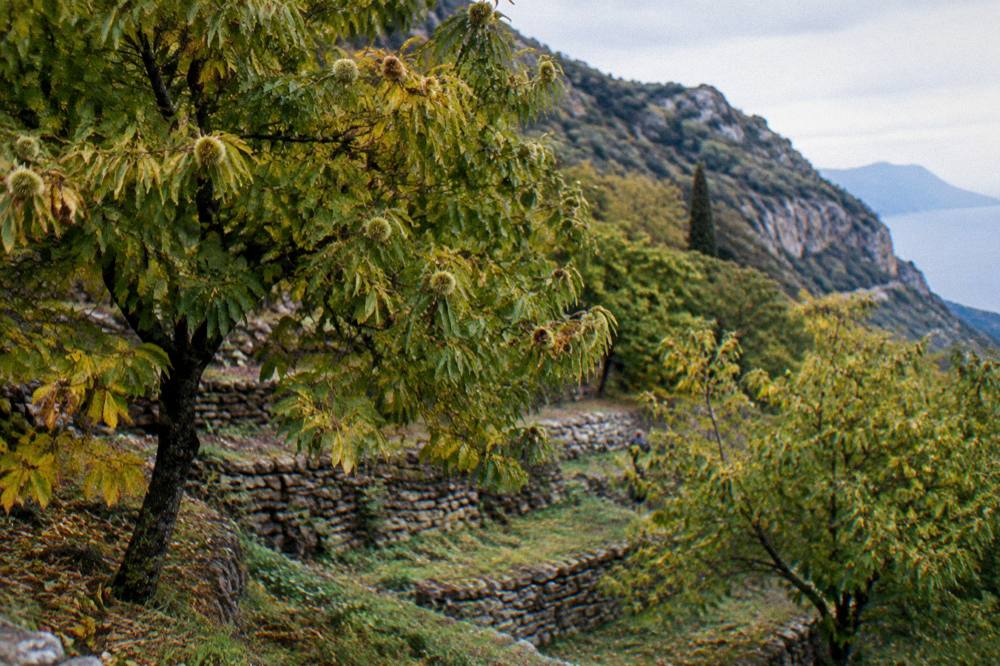
Kosmas is a mountain village on the Parnon range above Tsakonia, traditionally a herding settlement, set in clearings of chestnut and fir with views across the Argolic and Myrtoan coasts. It is reached by a climbing road from the Leonidio side or from the north, and it functions as the cool-air counterpart to the valley towns, busy in the summer months when the coast is hot.
The village's economy was built on herding and chestnut cultivation, and its plateia, the central square under plane trees, remains the reason people stop: shade, mountain air, and a stillness that the coast loses in July. The HNMS Argos station, 1980 to 2010, is the nearest official climate record this site holds, and while it measures the plain rather than the mountain, the principle transfers directly: mean daily highs in July and August run 34.0 and 33.7 C at the station, and a Parnon village at altitude runs noticeably cooler than the valley floor below it. That contrast is the whole logic of the Kosmas leg.
For a day trip from Nafplio, Kosmas works best as the high point of a loop, literally and in planning terms: out through the southern Argolid to Leonidio, up the mountain to Kosmas, and back. Check the current price of anything you plan to buy or book on the spot before you go, and confirm locally that mountain roads are clear, since winter weather in the Parnon can close the high routes.
How Does A Tsakonia Day Trip Compare With Nafplio's Other Long Drives?
Tsakonia is one of several long day trips out of Nafplio, and the computed drive times make the comparison plain: Monemvasia is about 219 minutes and 208 km from Syntagma Square, Mystras about 124 minutes and 128 km, Ancient Olympia about 186 minutes and 173 km. Leonidio and Kosmas sit in the same category of full-day mountain driving, closer in spirit to Monemvasia than to the half-hour runs to Tiryns or Tolo.
No figure for Leonidio or Kosmas appears because this site's sources do not give one for those destinations.
| Destination | Drive time from Syntagma Square | Distance by road |
|---|---|---|
| Tolo | about 17 minutes | 11 km |
| Argos | about 18 minutes | 14 km |
| Mycenae | about 32 minutes | 25 km |
| Epidaurus theatre | about 41 minutes | 28 km |
| Corinth Canal | about 72 minutes | 69 km |
| Ermioni | about 96 minutes | 73 km |
| Porto Heli | about 98 minutes | 78 km |
| Mystras | about 124 minutes | 128 km |
| Ancient Olympia | about 186 minutes | 173 km |
| Monemvasia | about 219 minutes | 208 km |
The trade-off is clear. The northern Argolid runs, Mycenae and Epidaurus above all, are short and site-heavy, while the southern and eastern legs are about landscape and driving. If your days in Nafplio are limited to two or three, the three-days-in-nafplio structure puts the UNESCO sites first and treats Tsakonia as an overflow day. With five or more days, the mountain loop earns its place, especially in the heat of July and August when the coast is at its most punishing.
What Should You Know About Driving In The Parnon From Nafplio?
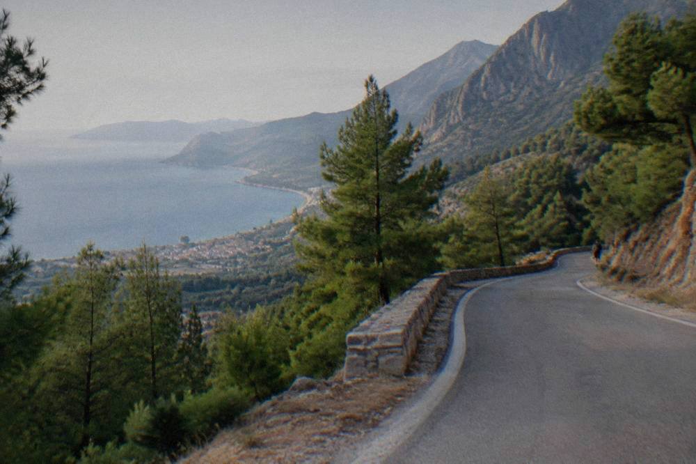
The drive from Nafplio into Tsakonia is mountain driving after the southern Argolid plain: bends, gradients and single-lane stretches through villages, with fuel and services thinner once the plains end. Fill the tank before leaving the Nafplio area, set out early, and plan to be off the high roads before dark, when unlit bends and local wildlife make the descent slow.
A few practical notes drawn from what the region is, rather than from any operational detail this site holds. There is no train to Nafplio and none into Tsakonia, so the car, a rental or a private arrangement is the only realistic way in; the nafplio-car-rental guide covers the base options. There is no scheduled public ferry or air link anywhere on this route, and no scheduled ferry runs from Nafplio or Tolo even on the coastal side, older guides that say otherwise are out of date, and the islands are reached by seasonal day cruise or from another port. The emergency number in Greece is 112, and the General Hospital of Nafplio switchboard is +30 2752 361100; beyond Nafplio, medical facilities thin out toward Tsakonia, which is a reason to carry what you need rather than plan to buy it en route.
Season matters. The HNMS Argos station, 1980 to 2010, records mean daily highs of 31.4 C in June and 34.0 C in July, with November the rainier month on the plain at 82.5 mm against June's 8.9 mm, and rain days climbing from 3.0 in June to 12.2 in December. The Parnon amplifies both ends: cooler in summer, and in the wet months subject to closures and rockfall on the high roads. Check conditions locally before a winter attempt.
Can You Combine Leonidio And Kosmas With Other Stops Near Nafplio?
Yes, in one direction only: Tsakonia pairs naturally with a coastal return through the south-eastern Argolid, and Kosmas itself can be threaded between Leonidio and the Parnon road back toward the north. It does not pair with the northern Argolid sites, Mycenae, Tiryns or Epidaurus, without turning the day into more driving than sightseeing.
The clean structures are these. One: Nafplio to Leonidio, up to Kosmas, and back the way you came, the shortest loop. Two: Nafplio to Leonidio, up to Kosmas, and back over the Parnon toward the central Argolid, a longer loop that trades distance for variety. Three, for a two-day version: overnight in the region and continue to Monemvasia, about 219 minutes and 208 km from Syntagma Square, on the second day, a pairing that suits a peloponnese-road-trip-itinerary rather than a single outing.
The state sites of the Argolid keep their own hours and prices: Palamidi, Mycenae and Epidaurus each cost 20 euro full and 10 euro reduced in 2026, per the Ministry of Culture's visiting pages, and the reduced ticket is sold only from 1 October to 31 May. Splitting the day means arriving at one of those sites late and rushed, and the mountains reward the opposite rhythm.
| State site (2026) | Full ticket | Reduced ticket |
|---|---|---|
| Palamidi Fortress | 20 euro | 10 euro (1 Oct to 31 May) |
| Mycenae | 20 euro | 10 euro (1 Oct to 31 May) |
| Epidaurus theatre and sanctuary | 20 euro | 10 euro |
| Bourtzi | 7 euro | 5 euro |
| Archaeological Museum of Nafplio | 10 euro | 5 euro |
| Argos agora and theatre | 10 euro | 5 euro |
| Asini | 5 euro | 3 euro |
What Is There To Do In Tsakonia Beyond The Two Villages?
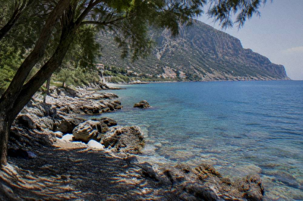
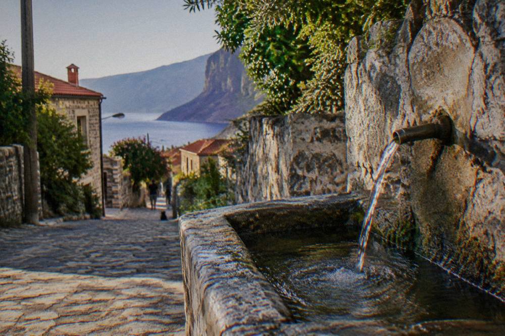
Tsakonia's appeal beyond Leonidio and Kosmas lies in its landscape and heritage: terraced farming valleys, the Parnon's chestnut and fir slopes, a quiet rocky coastline toward the south-east of the Argolid, and villages where the Tsakonian building style survives. None of it is a ticketed attraction, so the day is shaped by walking, driving and eating rather than by opening hours.
That shape is the region's strength and its limitation.
For travellers who want a guided structure rather than self-driving, the Argolid's organised products concentrate on the north of the region, and the honest advice is to take the guided day for the north and keep Tsakonia as the independent day. The featured option on this page is the four-stop Mycenae, Ancient Corinth, Corinth Canal and Epidaurus day trip, which covers the region's headline sites in one loop out of Nafplio, and the mycenae-and-epidaurus-tours page compares the alternatives in detail.
When Is The Best Time Of Year For A Nafplio To Tsakonia Trip?
Late spring and early autumn are the strongest windows: the HNMS Argos station, 1980 to 2010, records mean daily highs of 26.5 C in May and 29.7 C in September against 34.0 C in July, and the mountain roads are clear of winter risk in both. Summer works too, but the logic reverses, with Kosmas serving as the cool escape from a hot coast rather than a viewpoint on a mild one.
The monthly picture from the station, an inland record about 10 km north-west of Nafplio, is below. It measures the plain, not the Parnon, so read it as the baseline the mountain modifies.
| Month | Mean daily high (C) | Mean daily low (C) | Rain (mm) | Rain days |
|---|---|---|---|---|
| April | 21.3 | 6.7 | 33.7 | 8.6 |
| May | 26.5 | 10.5 | 18.7 | 6.2 |
| June | 31.4 | 14.0 | 8.9 | 3.0 |
| July | 34.0 | 16.7 | 9.1 | 2.1 |
| August | 33.7 | 16.8 | 13.0 | 2.5 |
| September | 29.7 | 14.2 | 20.3 | 5.0 |
| October | 24.7 | 11.5 | 44.3 | 6.9 |
| November | 19.2 | 7.7 | 82.5 | 9.4 |
Two seasonal notes finish the picture. Winter trips are possible in principle but depend on the high roads, which this site's sources do not report on, so confirm locally before committing. And any spring or autumn visit that also touches the state sites should note the free-admission days that apply across Greek state sites: 6 March, 18 April, 18 May, the last weekend of September, the first and third Sunday of each month from November to March, and 28 October, per the Ministry of Culture's site pages.
What Should You Pack For A Day In The Parnon From Nafplio?
Pack for two climates in one day: strong sun protection and water for the valley floor at Leonidio, plus a layer for Kosmas, where a mountain village at altitude runs cooler than the plain even in July, when the HNMS Argos station, 1980 to 2010, records a mean daily high of 34.0 C and mountain evenings fall well below that. Sturdy shoes matter more than on the Nafplio Old Town circuit, since village streets and trails are uneven.
| Item | Why it earns its place |
|---|---|
| Water, carried from Nafplio | Services thin out beyond the southern Argolid plain |
| Sun hat and sunscreen | The valley floor offers little shade away from the plateia |
| Warm layer | Kosmas sits high, and the temperature drops with altitude |
| Closed walking shoes | Village lanes and any trails are stone and uneven |
| Full fuel tank before leaving Nafplio | Fewer fuel stops on the mountain legs |
| Offline map or downloaded route | Phone signal in the Parnon is not something to rely on |
| Cash in euro | Small villages do not all take cards; no fee figures are held |
What can be planned with confidence is the shape of the day, and that is what the table above reflects.
Is A Guided Tour Or A Self-Drive Day The Better Choice From Nafplio?
Self-drive is the only format that reaches Tsakonia, because the organised day trips out of Nafplio concentrate on the northern Argolid and the Corinth axis; guided products, including the featured four-stop Mycenae, Ancient Corinth, Corinth Canal and Epidaurus day, cover the ticketed circuit instead. The honest split is this: take the guided day for the archaeology, and drive yourself for the red cliffs and the mountain.
The reason is arithmetic as much as anything. Tsakonia runs the other way, into terrain where the value is the driving itself.
For travellers based in Athens rather than Nafplio, the same logic holds in reverse: the Nafplio-and-Argolid day trips from the capital are the guided option, and a Tsakonia day needs a Nafplio base. The nafplio-day-trip-from-athens guide covers that pairing.
Wine lovers with an extra day can also point the car north instead of south-east: the vineyards of Nemea are the region's other inland detour, and a dedicated Nemea vineyards tour from Nafplio is listed on this site.
Common Questions About Leonidio And Kosmas From Nafplio
How far is Leonidio from Nafplio?
Leonidio lies south-east of Nafplio in Tsakonia, in the south-eastern Argolid. This site's sources give no drive time for that specific route, so plan it on a mapping service before setting out and treat the pair as a full-day trip.
Is Leonidio worth visiting from Nafplio?
For a traveller with four or more days in Nafplio, yes: the red cliffs behind the town are a landscape the rest of the Argolid does not offer, and the town is a working agricultural centre rather than a resort. With only two or three days, the Mycenae and Epidaurus circuit comes first.
What is Kosmas in Greece?
Kosmas is a mountain village on the Parnon range above Tsakonia in the Argolid, traditionally built on herding and chestnut cultivation, and used as a cool-air escape from the hot coast in summer. It pairs naturally with a Leonidio visit on the same loop.
Can you visit Leonidio and Kosmas without a car?
Not realistically. There is no train to Nafplio and no scheduled service this site can state into Tsakonia, so the trip depends on a rental car or a private arrangement; confirm any transport option locally before planning around it.
What is Tsakonia?
Tsakonia is the traditional region of the south-eastern Argolid around Leonidio and the Parnon villages, associated with the Tsakonian language, a descendant of ancient Doric Greek, and with its own building and farming traditions.
When is the best month for a Tsakonia day trip from Nafplio?
May and September: the HNMS Argos station, 1980 to 2010, records mean daily highs of 26.5 C in May and 29.7 C in September, against 34.0 C in July, and the mountain roads are clear of winter risk in both months.
The red cliffs of Leonidio and the chestnut shade of Kosmas are the Argolid's answer to travellers who have already stood at Palamidi Fortress and Mycenae and want the region's quiet half. Plan the route, fill the tank, keep the mountain for the cool part of the day, and Tsakonia will do the rest.